City in layers-part 6- An urban design concept is the sixth article of a series1,2,3,4,5. In fact, this article aims to analyze London’s urban design between 2000-2015. Specifically, to discuss the existing and organization and city systems connections. Furthermore, the change from urban sprawl and uncontrolled densities to mixed use development. Despite the officials’ and planners’ experience, they have failed to find an effective resolution for London.
The city between (2000-2015)
City in layers-part 6- An urban design concept, Organizing & connecting the city systems
To start with, the City plan in the 19th century included several transport matrices. As a result of the research, they are connected arbitrarily, and in some areas were planned by nodes. Every matrix is physically understood as a city layer. These layers connect the suburban to the city’s vital heart. Hence, the city’s heart became a busy commercial center attracting commuters from other cities. Also, the inner city could not take the increase in traffic volume that created congestion. Authority officials continuously put solution plans for the unplanned areas. Finally, they redesigned the transport network to become well-connected and organized.
On ground, train lines connect the other cities to the heart transport nodes. Moreover, underground train lines included excavation under buildings to reorganize the lines and link them to over overground train lines nodes. Hence, underground train lines in many city areas follow the road network system. As indicated earlier, water transport lines (blue ribbon) from the industrial revolution era used to transport goods. Officials prepared plans to develop the lines (to make a layer) that connect other transport layers in major transport nodes. Therefore, transport nodes in the city took advantage of open urban space and public areas to develop new transport nodes.
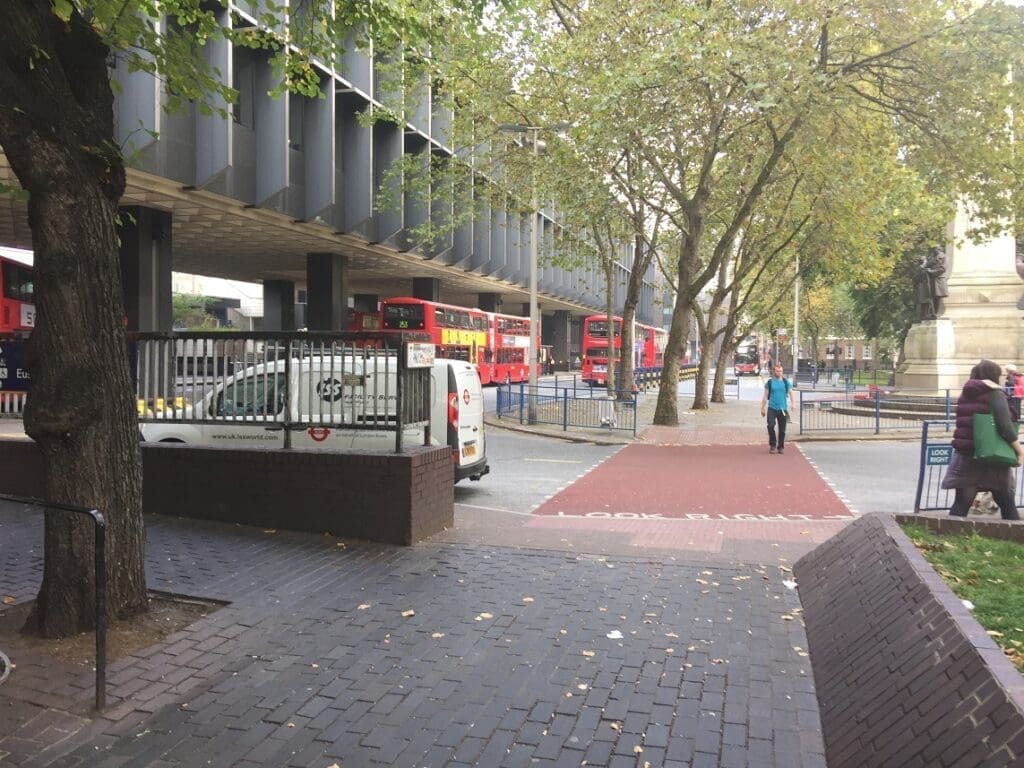
Voids in the city heart, including: open urban space, public spaces, squares, and round about where transformed into nodes to connect the transport systems. Due to the complexity of some of these voids in terms of location made officials to keep them out of these plans. Furthermore, voids existed in many areas in the city that made officials select some of them to keep the transport system organized. Because of the feasibility of construction factors, voids were included that make the system easy to construct. Surely, voids in the city, where a good location to connect all transport systems lines became a development priority.
City Green spaces include large-scale parks, small parks, gardens, and landscapes within squares. Open spaces offer people sports grounds, a diversity of wildlife, and a place for special events and social gatherings. Specifically, former royal parks used for hunting become public parks. In addition, these public parks were always located near water beds for irrigation and flood control. Hence, they were unplanned accidentally located in relation to the population. Council officials always targeted a plan to connect all green spaces in the city. They planned to rearrange and organize these green spaces to form a network of parks and gardens.

City in layers-part 6- An urban design concept, towards high density & mix use development.
Due to the country’s approach with its new policies towards global fund development began in London. Several large-scale developments started with global fund support. Such as Qatar-based funds to develop the London Bridge railway station. Also, European funds, Chinese former Expo 2010 companies to fund the Royal Docks project. Furthermore, public sector planners focused on Brownfields, old residential areas, and former industrial zones regeneration. Projects designed to increase high-rise mass and connection with urban space. Hence, all buildings took a mixed building construction approach. The city population was shifted with their related factories and workshops to the boundaries in earlier years.
The unplanned transport lines of several types in the city created more problems than traffic jams. Therefore, a redesign of the transport types to become organized systems happened in the late 19th century. The voids in the city were subject to transformation to link the transit nodes. Parks and gardens became a green space system. Hence, the open green space was connected with the transport system nodes. Reasonably, urban development focused on clearing out old buildings and Brownfield areas. Also, the Building’s design was changed to high-rise and mixed-use, connected by urban space.
To sum up, the city witnessed unplanned design activities. Buildings were not located properly in relation to densities and green areas required. Green areas plotted randomly and water lakes located to serve industry. Train lines built when access to lands was easy. Underground train lines dug in easy to build areas. Planners and relevant responsible work were uncoordinated. Rearranging and reorganizing these systems required big funds and global intervention. The failure falls on the city council and their planners and architects to achieve good working systems. The proper approach is to design and plan every part of the city as a layer. Every team designing or planning any layer to coordinate with others. And finally, a responsible to watch the design, plan, manage, coordinate, and implement all this work is the URBAN DESIGNER.
in the following article I will reflect the city in layers concept on one of my urban developments I have worked on in the Middle east as the urban design in practice.
Following, I inserted a list of references that supplied the research. In addition, a reference list for further reading.
- Trancik,Roger.(1986) Finding lost space .New York-USA : Van Nostrand Reinhold
- Cuthbert, R.Alexander. (2011) Understanding Cities method in urban design. Oxon-UK ,Routledge (Taylor & Francis group).
- Shane, David Grahame. (2011) Urban design since 1945. West Sussex-London: Wiley & Sons Ltd.
- Lynch, Kevin. (1960) Image of the city .London-UK: MIT Press.
- Tallon, Andrew. (2013)Urban regeneration in the UK. Second edition.Oxon-Uk: Routledge (Taylor & Francis group).
- Lang, Robert. (2003) Edgeless Cities are exploring the elusive metropolis. Washington-USA: Brookings Institution’s press.
- Wallinger, Mark. (2014)Labyrinth a journey through London’s underground .London-Uk: Arts book Publishing.
- Carmona et al .(2003)Public places , urban spaces – the dimensions of urban design .Oxford-Uk : architectural press.
- Laurie, Micheal. (2002)Introduction to landscape architecture. New jersey –USA: PTR prentice hall.
- Czerniak, Julia&Hargreaves, Jeorge. (2007)Large Parks. New York-USA: Princeton Architectural Press.
- Turner, Tom. (1998)Landscape Planning and environmental impact design.London-Uk: UCL Press.
- Osborn, F.J. (1946) Garden cities of tomorrow. London-UK: Faber&Faber.
- Cherry, Gordon E. (1972) Urban change and planning – a history of urban development in Britain since 1750.Oxfordshire-UK: GT Foulis & CO LTD.
- Liversedge, Jamie&Holden, Robert. (2014)Landscape architecture an introduction. London-UK: Laurence King LTD.
- OC, Taner&Tiesdell, Steven.(1997)Safer city centers reviving the public realm . Liverpool-UK: Paul Champon Publishing.
- Evans, Alun Sylvester. (1980) urban renaissance a better life in towns.England-UK: Robert stockwell LTD.
- Longley,Paul&Batty,Michael.(1994)Fractal Cities a geometry of form and function .London-Uk: Academic Press
- Greeves, Ivan .S. (1980) London Docks 1800-1980 a civil engineering history. London-UK: Thomas Telford Limited.
- Trench, Richard.Hillman, Eliss. (1985)London under London a subterranean guide.London-Uk: John Murray LTD.
[…] are also part of the human system that uses cyberspace and the internet. Urban design as a profession is to plan, manage, coordinate, and implement a development plan. When he is in the process of […]
[…] the harbor creating eco-friendly districts. The green space and open space connection and network (city in layers) are shown in Figure […]
[…] sixth article I have showed the city politicians’ activities and their planning directions to develop the […]